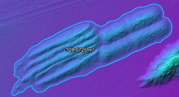
Hi everyone! I'm new to drone mapping and have been using WebODM for woodchip stockpile volume measurement at our timber yard. I really enjoy the software, but I'm running into accuracy issues that I can't seem to resolve. I've been doing comparative tests using the same set of 87 images (DJI Mini 4 Pro, GSD ~0.69 cm) of a stockpile with a known volume of 361 m³. WebODM consistently gives me volumes in the range of 311–328 m³, which is a 9–14% underestimate. When I processed the same images independently in Pixpro and Pix4Dcloud, both came in under 2% error (around 357–359 m³). The stockpile has an irregular shape (several loads dumped side by side) and sits on a slightly sloped asphalt surface. I've experimented with various processing settings and also tried measuring in CloudCompare using a fitted ground plane — but the gap persists regardless. Since the same images produce accurate results in other software, I suspect the issue might be in how WebODM generates the dense point cloud for this type of surface. Has anyone experienced something similar? Any advice would be greatly appreciated!