Hi, I'd like to know if there's a way to view the DSM and DEM through the 3D interface, instead of just the 2D raster, so I can take measurements as I naturally do with the textured model in the program's 3D tab? It's a feature that would be very helpful for civil construction.
View DSM and DTM via the 3D tab
11 Replies
Hi, currently not; but I'm curious, for measurement purposes, isn't making measurements from the point cloud sufficient from the 3D tab?
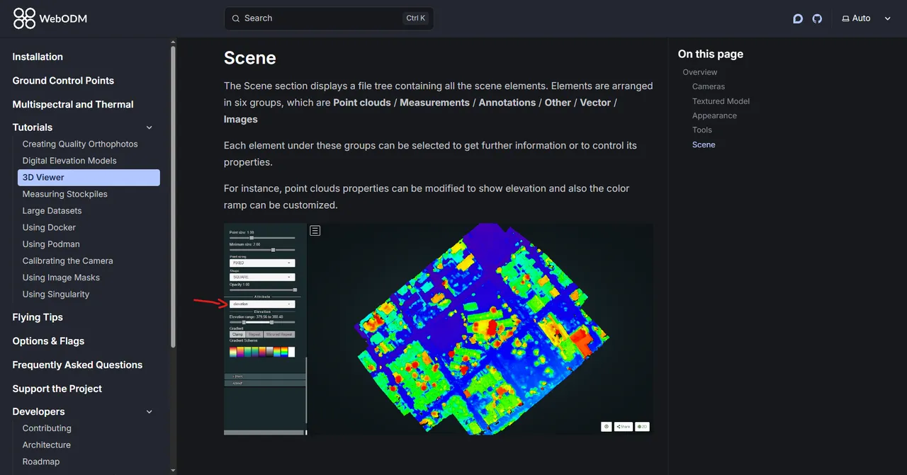
Yes, if the goal is to obtain the same data as the DSM, it's feasible to take measurements using the 3D model it renders; however, the visualization is different. However, after rereading the program's documentation, I saw that it's possible to classify the 3D model's point cloud by elevation, resulting in a visualization more similar to the DSM it creates in 2D (or perhaps it's the DSM itself in its three-dimensional form? After all, it shows buildings, trees, etc., just like in 2D).
However, considering the use of the results for civil engineering, a 3D visualization of the DTM would be even better, as it would disregard buildings, trees, and anything else that isn't part of the terrain. Sometimes when I'm taking measurements, I accidentally include a building; sometimes I can get around the building by taking other routes, but sometimes it's impossible to measure accurately because there's always a building in the way.
Ah I see; note that if the point cloud is classified, you can toggle the non-ground points in the 3D visualization and keep only the ground ones
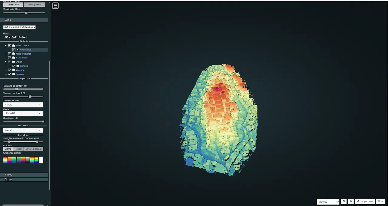
This would be very useful for me, however I can't find the option to disable points that are not part of the terrain in the 3D model. Attached is a screenshot of the 3D view of an area I'm working on, where I've set the view based on elevation. I used these options for processing this project: auto-boundary:true, pc-classify:true, pc-rectify:true, dsm:true, dtm:true, dem-resolution:1.0, orthophoto-resolution:1.0, no-gpu:true, optimize-disk-space:true
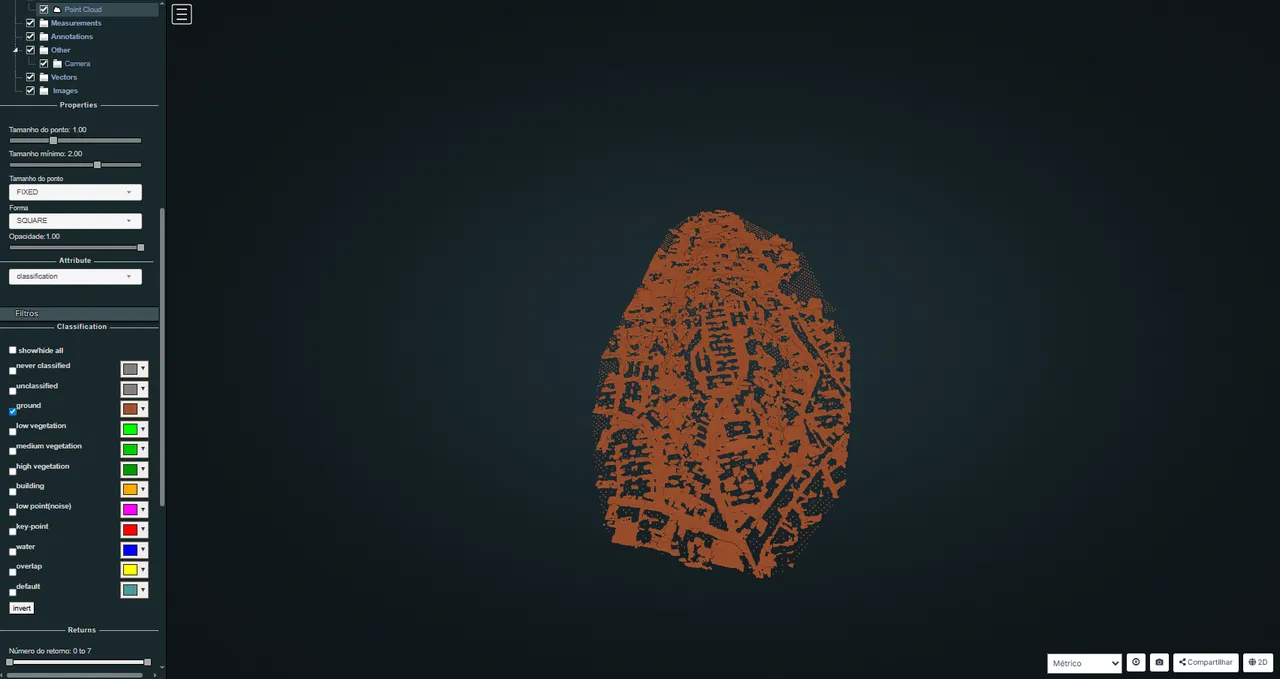
I dug around a bit more in the options and I think I found what you meant. I was in the filters tab and there I turned off all the points that aren't terrain.
Is the documentation page available on Github? I think it would be helpful to include this information for future users who might need it. If so, I'll create that part of the documentation myself and commit it.
That would be amazing. 🙏 Yes the documentation can be edited by anyone. https://github.com/WebODM/Docs or from any documentation page, search for the Edit Page link at the bottom
Perfect! I'll start writing as soon as I finish this project, thank you very much @pierotofy 🫶
Need more help?
This discussion happened in the WebODM community Discord. Join and ask your own question.
Join View Original ThreadThis page mirrors a public discussion from the WebODM Discord. How to request a removal.