Need advice and info about my dataset and results

Gregplume

Hi,
I am quite new to photogrammetry.
The drone is a mavic Air2S, AGL is 30m
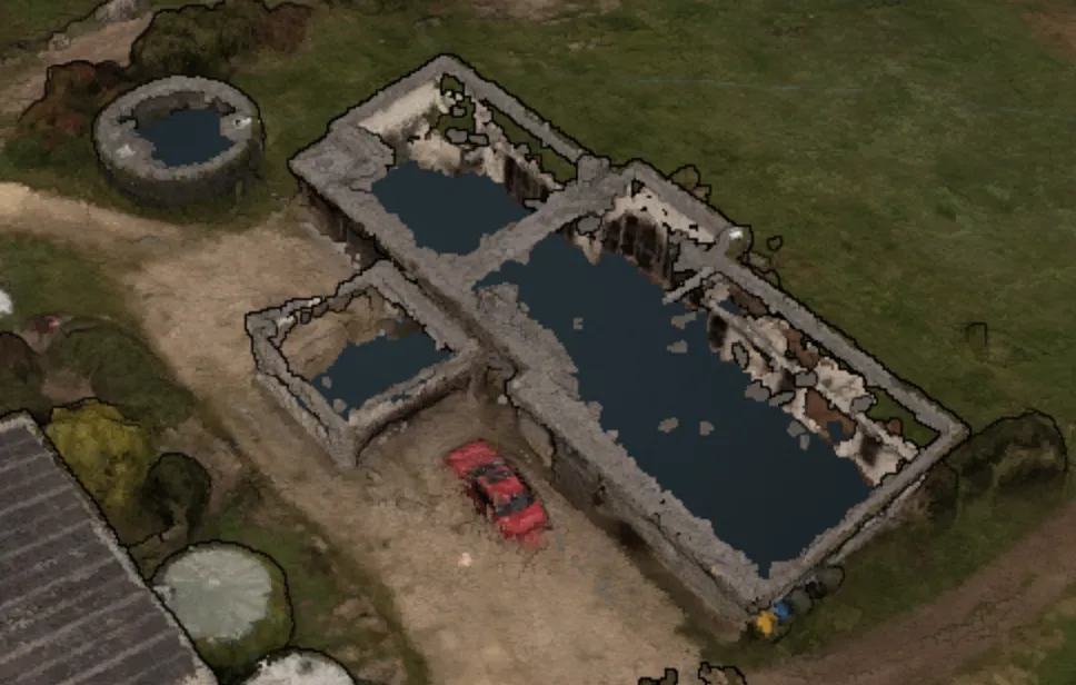
I get weird holes in some spots of the roofs but not others, and only on the corrugated sheet metal ones. Does any one knows why? the DSM model is also wrong in those spots.
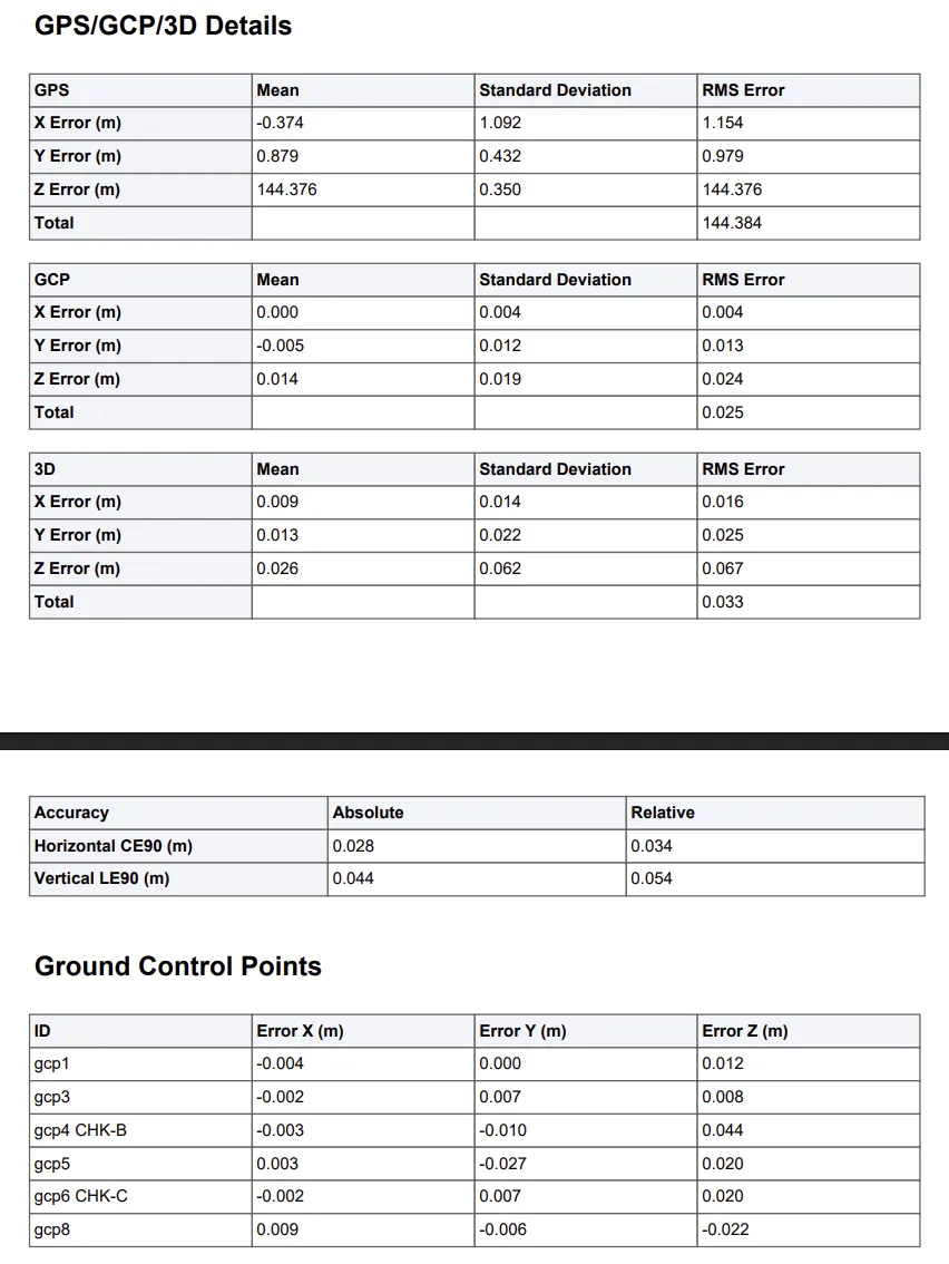
Also, i used gcps and try to make some of them as checkpoints but it didn't seem to work. And why do i have a mean GPS Z error of 143m?
I am including the pictures and all assets in a google drive link.
Also, if you see anything else that needs improvement tell me!

https://drive.google.com/file/d/1NEQ1w3GIbn6ydBWA_dCnCzDg8lROuihm/view?usp=sharing

8 Replies

Gregplume OP

No solutions was given, but i will try increasing the feature count. Any insights about my other issues ? Thank you !

Gregplume OP

This what i am talking about

pierotofy

For the GPS Z error, I suspect your GCPs are probably in orthometric height, but GPS always reports ellipsoidal height, so you need to pick a more appropriate CRS for your GCP file or convert your GCP heights to ellipsoidal heights before processing

pierotofy

metal roofs are challenging to reconstruct due to reflectance, lack of features; here ODX didn't do a very good job

Gregplume OP

Okay i see, the height reported in the pictures is around 330m and the height reported by the gcps is around 410m

Gregplume OP

I still don't understand such a difference, the geoid height is around 3m where i took the pictures...

pierotofy

Then either the GCPs Z data is off, or the GPS Z data is off

Need more help?

This discussion happened in the WebODM community Discord. Join and ask your own question.

Join View Original Thread

This page mirrors a public discussion from the WebODM Discord. How to request a removal.