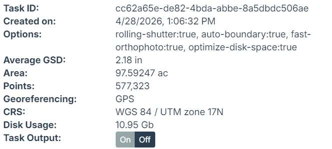
Hey team, I'm seeing a GSD discrepancy with DJI Mavic 3 Pro imagery and wanted to confirm if this is expected behavior.
The Issue:
- Mission flown at 80m altitude (confirmed in mission KMZ:
executeHeight=80) - DJI EXIF contains two altitude fields:
drone-dji:RelativeAltitude = +79.900(correct - height above ground)drone-dji:AbsoluteAltitude = +63.154(GPS MSL altitude)GPSAltitude = 63.154(same as Absolute)
WebODM's Output:
- Reported GSD: 5.5 cm/px
- This matches calculation using AbsoluteAltitude (63m)
Expected Output:
- GSD should be 2.18 cm/px (using RelativeAltitude of 80m)
- Formula: (17.3mm / 12mm) × 80m / 5280px × 100 = 2.18 cm/px
Question:
Does WebODM prioritize GPSAltitude over DJI's RelativeAltitude field? For drone photogrammetry, RelativeAltitude (AGL) is the correct value since missions are flown at constant height above terrain, not constant MSL altitude.
Sample EXIF from affected image:
drone-dji:AbsoluteAltitude="+63.154"
drone-dji:RelativeAltitude="+79.900"
drone-dji:AltitudeType="GpsFusionAlt"
Thanks for any insight! Let me know if you need sample images to test.
Grand-Bahamian-Way-4-27-2026-report.pdf
— view on Discord