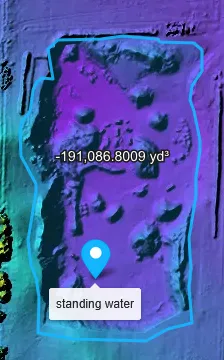
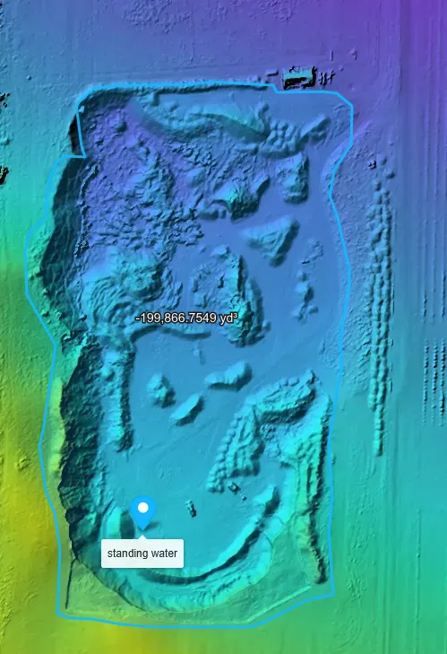
whats the best way to determine how much sand is being removed? i have 3 scans spaced 6 months apart
https://cloud1.webodm.net/public/task/6d4d5b44-9e63-47f1-87a2-89bca7987e80/map/?t=orthophoto
https://cloud1.webodm.net/public/task/464a8ba4-659a-4c13-9de2-2c07ff1dbabe/map/?t=orthophoto
https://cloud1.webodm.net/public/task/c2b343c6-d714-4ff2-8e04-41ef34f96418/map/?t=orthophoto
im trying the vol tool but getting wild results
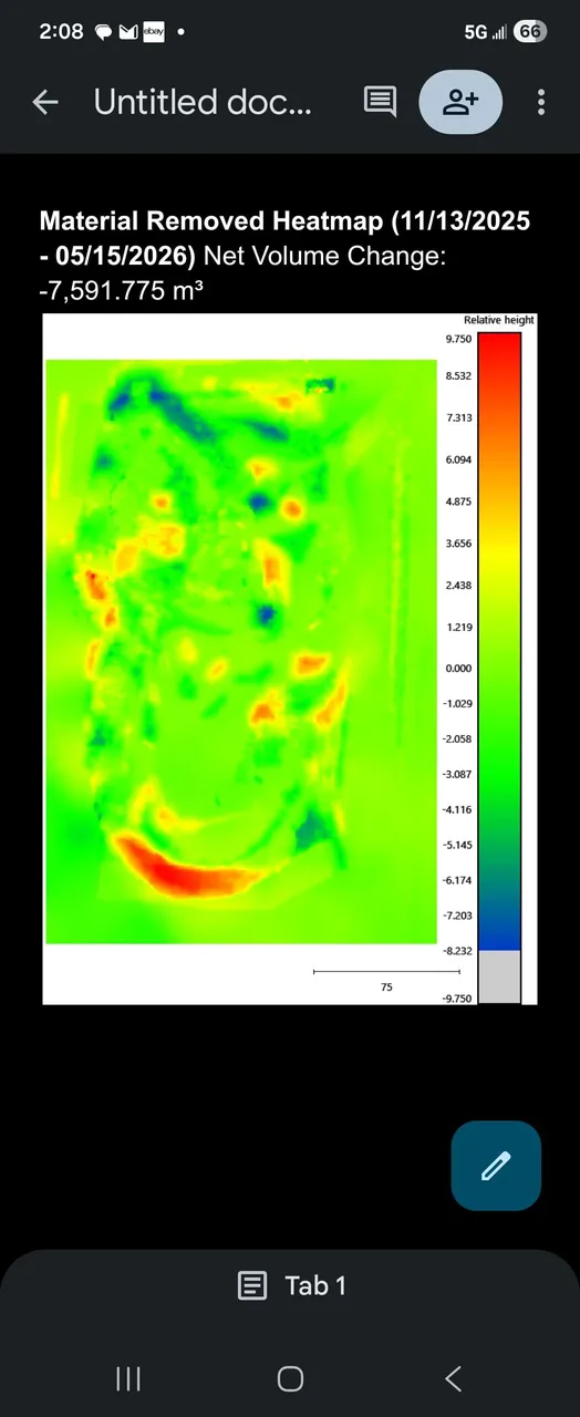
sand mine vol calc
52 Replies
it seems every time i try to repeat the vol measure i get a wild diffrent result
This is from cloud compare using the point clouds
the first image is 6 months after the secont one
but the volume decreases
Looking at the DSM, it seems you had different processing options between the two captures.
Let me check
11/13/2025 was set to high res
Others on default
I just set all 3 to high and am restarting
for the base surface, I would probably use the triangulation method, making sure to have sufficient points defining the triangulated surface
thats what ive been using, @YanNoun pointed out i had diffrent options so im trying high res for all 3 and will try again
im thinking i want my points to include the piles around the pit so that im only measuring material taken away on dump trucks
you have to be careful though, it's a large hole and the base surface has a really large impact on the measurement; you might want to use cloudcompare if you want more control over it
so maybe my best option would be to really hug pit with my points>
?
once these are done recomputing on high res ill do a vol calc on all 3 and you can take a look
we are having a horse show in a few minutes so ill have to send the output in a few
thank you for your help so far
my boss wants to use these results in court as the sand mine is very illegal\
not sure how that will go
When comparing volume, do i want to draw a new boundary for each one ore draw one for the biggest one and reuse it on the smaller ones?
i think these are pretty good
shows a steady amount of sand removed and passes the sanity check as on weekdays more than 1 full dump truck leaves every day
unless you're using GCPs I would draw a new one
One more thing @pierotofy I have a point cloud of the landmine from a lidar survey I can't find a way to use it for volume calculation
You need a DSM or DTM to perform volume calculations using the 2D tools
could you break it down barny style for me?
meaning you can't use the lidar survey directly
if you can generate a surface model from the lidar survey in GeoTIFF and import that into Lightning, then you can do volume measurements
do you know of any such tools?
Cloud Compare
GeoTIFF must have a valid CRS
im getting this error when trying to inport from cloud compare
i cant seem to find a way to assign it
ok hold the phone
how do theses numbers make any sense
the first one is a scan from 2013
and then 2026
volume is larger in 2013
but size is smaller and the altitude of the bottom is the same
Mm, not sure. But your Task of 2026-06-02T17:30:30.133Z task seems to have a different resolution as well as a different base surface. I would look there.
p.s. please no @ mentions for help questons 🙏 this is a public place for discourse for everyone, pinging people directly does not help speed up the response
My apologies for the @
The task is from a lidar scan, but it all seems to look Okey and lines up with satilite images from the time
But these volume calculations are double expected
And the 3d view if cut and fill seems normal
well boys, im hiring a guy on fiver to do my point cloud anal
I've opened a new help thread with more examples of the issue
Need more help?
This discussion happened in the WebODM community Discord. Join and ask your own question.
Join View Original ThreadThis page mirrors a public discussion from the WebODM Discord. How to request a removal.